
Why? This picturesque lake, set in the Sierra National Forest near Mammoth, CA, is named after its appearance: dotted with numerous rocky islands within the lake itself. The lake itself is formed from the bottom of a valley from glacial erosion.
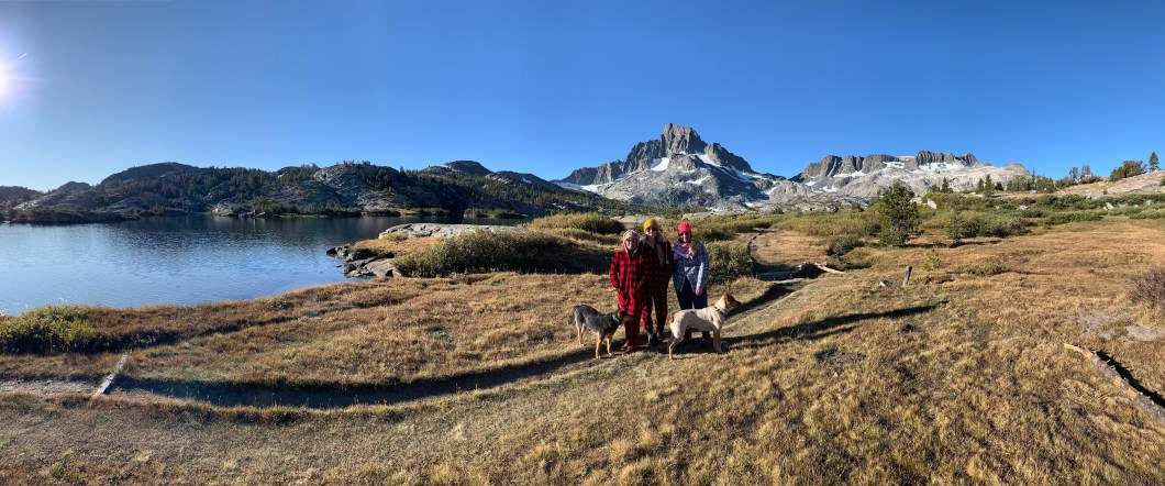
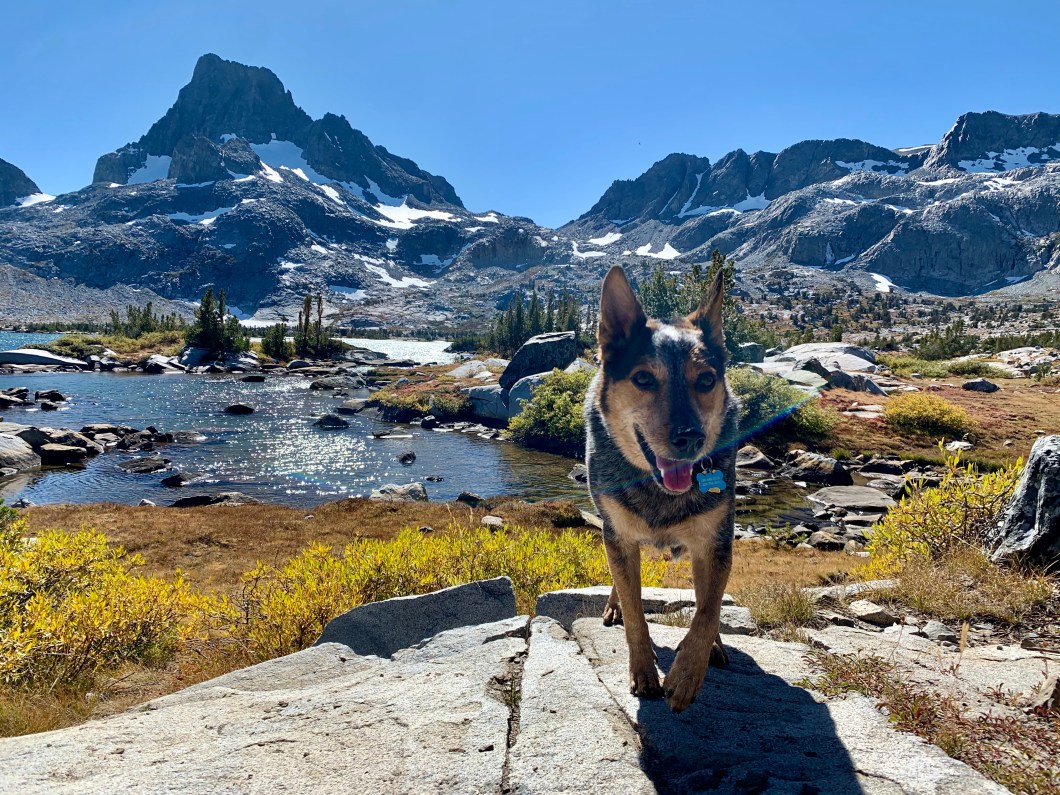 (My pup, Baloo, at Thousand Island Lake with Banner Peak in the background)
There are several ways to reach this beauty, via
- Pacific Crest Trail (PCT)
- John Muir Trail (JMT)
- Sierra High Route
- High Trail (aka Agnew Meadows).
We chose the latter, via High Trail, because it was the “easier” of the 4 choices. The trail from Agnews Meadows is only 14.3 miles out & back and is rated on Alltrails as “difficult” and is the northbound section of the PCT. The trail itself does get steep in some sections but reports from the half of my group (that started from Sierra High Route instead) says that High Trail is significantly easier and shorter than their route. And of course the number one reason is that High Trail has sweeping views and I am ALL ABOUT THE VIEWS. The trailhead at Agnew Meadows starts at 8,340 ft elevation and ends at Thousand Island Lake at 9,840 ft elevation.
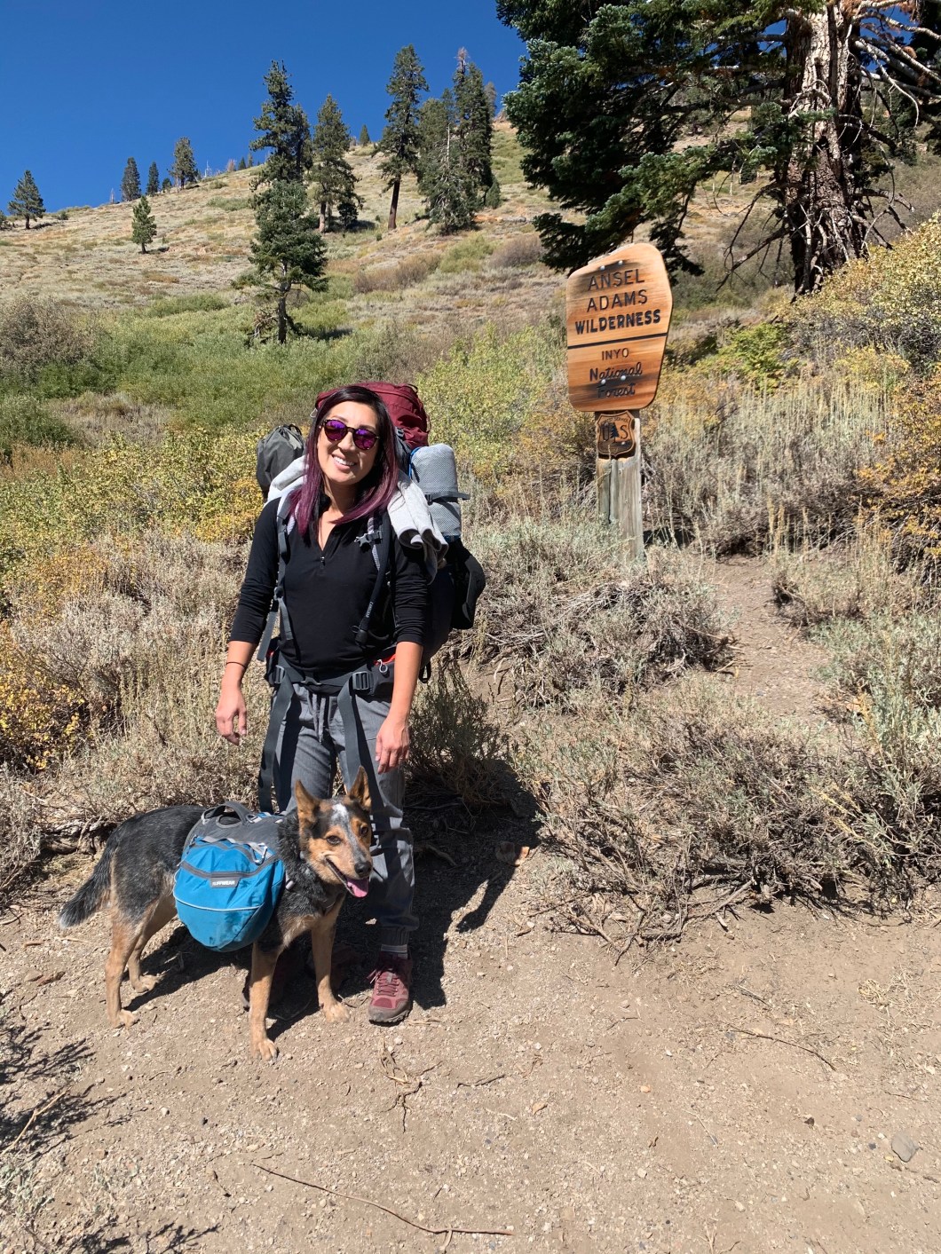
Another tidbit of info: I try to only backpack trails that are dog friendly, as you can see above in the photo. Also, when staying overnight/backpacking, you must obtain permits. Because we came in from Mammoth and started our route at High Trail, we grabbed ours from Mammoth Ranger Station since it was on the way. This was last-minute so we did walk-in permits. However, if you plan in advance:
Bookings open up 6 months in advance and you will likely need a shuttle to reach High Trail trailhead. For more info: https://www.fs.usda.gov/recarea/inyo/recreation/hiking/recarea/?recid=20538&actid=51
If you see a W displayed it means space will be added for short-term reservations 2 weeks before the trip at 7am Pacific time. Example: you would look on the recreation.gov website at 7am Pacific Time on the same day of the week, two weeks before your trip entry date.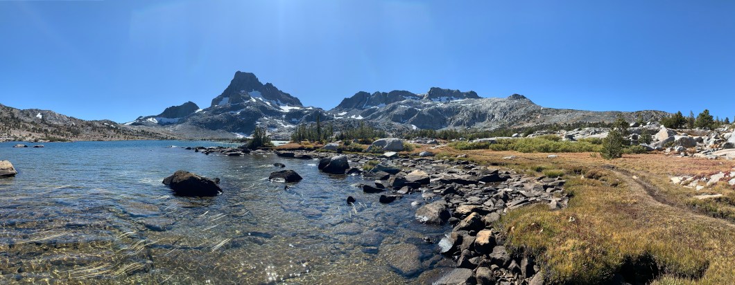
As someone who loves to backpack but has a DEEP HATRED and fear of mosquitoes (hypersensitivity to mosquito bites & have severe allergic reactions to bug bites while overseas), I like to backpack in early spring or early fall. Due to my work schedule, for this trip, my availability was early October. As you can see from the photos, there was a bit of snow on the ground when we went.
As you begin the trail and wind upwards, you’ll reach a sign in a brush area stating that you are in Ansel Adams Wilderness.
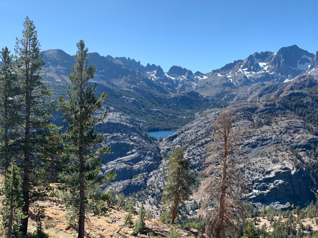
At this point, although the uphill makes it seem further, you’ve only covered 0.4 miles of the trail. You’ll reach a series of switchbacks after this point and once you reach the top of those switchbacks, you’ll start to get some great views. And the views only get better from there.
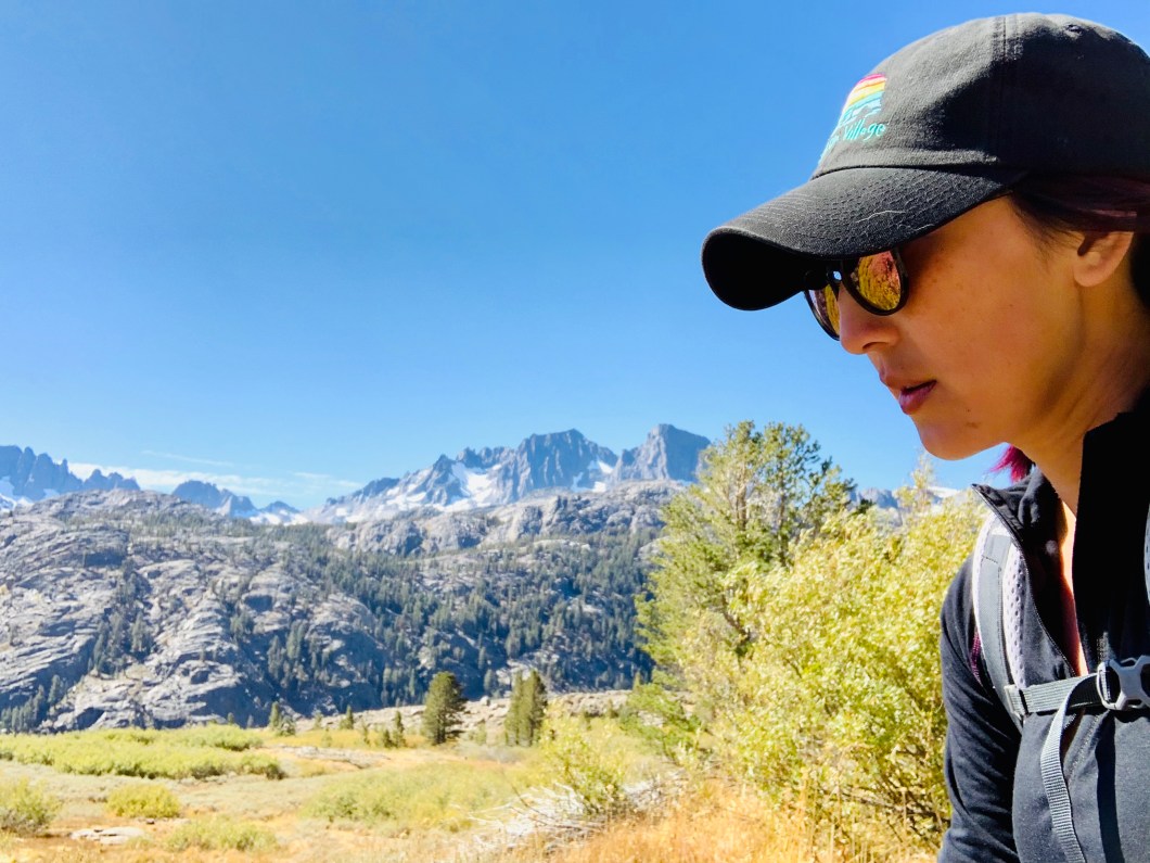 (some of the views on the trail)
As you start to see Shadow Lake from Agnew Meadows, you’ll know you’ve reached the 3 mile marker. You’ll end up reaching sweeping canyon views and, if it’s the same time of year that I went, fields of butterflies and deer crossings.
 (Shadow Lake)
After this point, you’ll come across several streams, so if you’re a thirsty hiker, fret not, there are plenty of places to replenish your camelback with your water pump. Enjoy these views while you can, once you pass some volcanic rock croppings, loosely resembling that of the Devil’s Postpile, you’ll drop into some trees. You’ll also run into some junctions between mile 5-7.5, but keep to the left and be studious to follow signs for Thousand Island. When you reach the River Trail junction at mile 7.75, continue right and there will only be another mile before you reach Thousand Island Lake. Once you hit the merger for the JMT and PCT junction, you’ve reached the end of High Trail and have reached the outlet of the lake.
You are not allowed to camp near the outlet and if you continue hiking along the lake, you’ll see a white sign with an illustration of the lake. The illustration will show you at what point you are able to set-up camp. I highly recommend hiking further in, alongside the lake, there are lots of sweet camping spots so don’t let your tired feet dictate where your shitty camp will be set-up lol!
 My group was tired, so we set up camp on some rocky outcroppings. While it was a decent view, the terrain was crap. When I took a hike further along, there were some nice grassy areas with great views that we could have camped on.
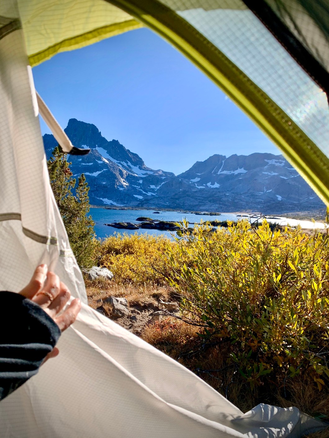
 While this photo looks nice and sunny, let me tell ya: it hit 19 degrees F the first night. Also, every morning was so cold that the frost froze the grass blades and ice froze clung to the edges of the lake. Sooooo if you happen to go around this time as well: dress warm and bring layers. However, the plus side was that there was NO ONE in sight. We had this lake all to ourselves. Damnit I love my solitude so much. I read that this spot can be a pretty busy backpackers destination so camping spots may become scarce.
